Lesson 1.1 — Environmental mapping and geographic tools
Digital mapping means creating digital maps. They can take the form of software, applications, and web platforms and are used to create, store, analyze, and visualize geographic and spatial data. In the context of environmental sustainability, they can be used to track deforestation, climate change, and natural disasters through satellite mapping. They can also assist in risk assessment and disaster response planning. We can distinguish three categories:
- Geographic Information Systems (GIS) are usually used by governments, urban planners, and researchers, and they allow the stacking of different layers of data. Examples: ArcGIS, qgis.
- Web & interactive mapping tools are are browser-based platforms and libraries, designed for developers and individuals to build custom, interactive maps or visualize location-based data. Examples: carto, Leaflet.
- And finally, personal & consumer navigation tools are designed for the general public to view satellite imagery, find locations, get directions, and track personal data. Examples include Google Maps and Google Earth. This is the most suitable category when first starting to use mapping & geographic tools and can easily be transferred into the classroom context.
You can help your students use these tools to map local biodiversity, track pollution sources, measure urban green spaces, and even investigate climate change impact. In the “practical exercises” part of this Module, we will provide you with a ready-to-use exercise to compare commuter footprints.
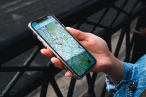
Photo by Stanislav Kondratiev from Pexels: https://www.pexels.com/photo/person-holding-smartphone-8824105/
Lesson 1.2 — Data collection and monitoring tools
Those tools are software platforms used to gather, store, and analyze information from users, devices, or systems. In the environmental sustainability context, they can be used for biodiversity monitoring, seasonal observations, species identification, and environmental data collection.
Since some of the platforms require creating an account, you should have a look before using them in class, depending on your students’ age and educational institution’s policies. You could also create one account with your info and use that with the whole class.
This is a list of ready-to-use tools for the classroom:
- iNaturalist: application on Google Play and AppStore & online platform. An online social network of people sharing biodiversity information to help each other learn about nature. It is for recording observations of individual living things. To use it, take a photo (wild plant, insect, bird, or fungus), upload it, describe what it is (the software also helps you identify what you saw), and wait for other iNaturalist members to check and confirm it. To use it in class, you can ask your students to take and upload photos of a specific category and review it in class, or give them a summer holidays assignment, asking them to observe local organisms.
- eBird: a global online database of bird records by hundreds of thousands of people around the world. Users can manage lists, photos and audio recordings, see real-time maps of species distribution, and even get alerts to inform them when species have been seen. To ensure the data remains of high quality, when entering sightings, users are presented with a list of likely birds for that date and region. These filters are developed by bird distribution experts and when unusual birds are seen, or high counts are reported, regional experts review these records. To use it in class, you can discuss the scientific process & data quality importance, ask your students to observe birds at school or at home, and even combine it with other subjects, for example ask students to explore the impact of rising temperatures caused by the climate change on specific bird species in your area.
- Earth Observatory by NASA: an online platform providing an array of different data and features. In the classroom, with “World of Change”, you can ask students to compare chronological images of a specific area and analyze the changes (i.e., the Amazon forest shrinking and its ties to climate change and beef production). With “My NASA data” (interactive datasets for the atmosphere, biosphere, and geosphere), you can explore concepts like the urban heat island effect, water cycles, and air quality. You could focus the analysis on your city, to make it more relevant and interesting for the students. And for younger students (9-14 yo), you can use Earth Obervatory for Kids, with PDF magazines that combine engaging stories with hands-on activities you can implement in your classroom.
- Globe Observer: an online community of everyday people who upload data to help track changes in the environment in support of Earth system science research, and interpret NASA and other satellite data. You can upload data of clouds, mosquito habitats, land cover, and trees. In the classroom, apart from asking your students to make and upload specific observations, you could:
- discuss how clouds regulate Earth’s energy balance and influence regional weather patterns,
- locate and identify potential mosquito breeding grounds to teach about vector-borne diseases and how changing climates expand insect habitats,
- photograph and categorize your city’s landscape (e.g., grass, trees, bare ground) to talk about the impact of urbanization and deforestation and its importance for mapping wildlife habitats, or measure the height of the same trees over multiple months to track growth rates and calculate carbon sequestration in your local area.

Photo by Vanessa Garcia from Pexels: https://www.pexels.com/photo/smiling-travelers-smelling-blooming-flowers-on-shrub-during-trip-6324197/
Lesson 1.3 – Other digital tools to use in the classroom
So far, we have explored digital tools specifically focused on environmental sustainability. There are, however, numerous apps and websites that can level up the learning experience in your classroom. We’ll have a look at some of the most famous ones.
- Quiz games: you can turn normal assessment into a fun quiz game (applicable in both face-to-face or online classes). Famous tools include Kahoot! , Wayground (formerly “Quizziz”) and Mentimeter, where you can use pre-made templates or make your own. You can integrate tools like these into your theory-teaching part, or even plan a knowledge contest among your students. Online quizzes can also be used as an ice-breaker or energizer activity.
- Collaborative learning: you can use interactive digital boards to present a lesson, provide feedback, or ask students to create a more detailed project. Mind Meister, Miro and Padlet are great tools for that, as well as for creating mind maps and having students split into smaller groups and work on a specific idea. Kaizena allows you to provide feedback with audio notes. For something more advanced than a Power Point presentation, you can use Google Slides, where presentations are created online and can also be downloaded – and depending on what level of access you grant them, students can view, comment, and edit the presentation. They also have several accessibility features. You can also use Canva to create (either by yourself, as teaching preparation, or by your students, as homework assignments and class activities) posters, infographics, and anything else that will enrich the lesson.
Online classes: with COVID-19 most teachers had to use online meeting tools and plan online classes. Even after the pandemic was over, many new tools and formats remained relevant, and hybrid classes have become much more common. While most tools and platforms are well-known nowadays, we will briefly mention a few. Some famous tools include Zoom, Google Meet, and Webex. For extra support during your online class, you can use Google Classroom , which has an easy interface, effective communication tools, and multiple permission levels.
For a more in-depth look, make sure to check out Module 2 – Introduction to DigiComp and Module 6 – The role of AI in Sustainability Education!
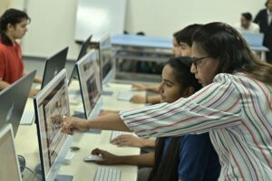
Photo by Poddar Group of Institutions from Pexels: https://www.pexels.com/photo/collaborative-learning-in-a-computer-lab-37563954/